
Thank you for supporting this site ❤️
Make a donation
Make a donation
Gear up for your next adventure:
As an Amazon Associate, this site earns from qualifying purchases at no extra cost to you.
Marbach topographic map
Click on the map to display elevation.
Thank you for supporting this site ❤️
Make a donation
Make a donation
Gear up for your next adventure:
As an Amazon Associate, this site earns from qualifying purchases at no extra cost to you.
About this map
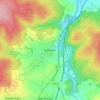
Name: Marbach topographic map, elevation, terrain.
Location: Marbach, Petersberg, Landkreis Fulda, Hessen, 36100, Deutschland (50.60059 9.70484 50.64059 9.74484)
Average elevation: 339 m
Minimum elevation: 261 m
Maximum elevation: 444 m
Thank you for supporting this site ❤️
Make a donation
Make a donation
Gear up for your next adventure:
As an Amazon Associate, this site earns from qualifying purchases at no extra cost to you.