Geolocate

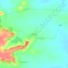
Umred topographic map

Click on the map to display elevation.

Umred

Umred is located at 20° 51' 14N and 17° 19' 29E, at an elevation of 290 meters above sea level. It's STD code is 07116.

About this map

Name: Umred topographic map, elevation, terrain.

Location: Umred, Nagpur District, Maharashtra, 441203, India (20.65078 78.97020 21.04664 79.42223)

Average elevation: 281 m

Minimum elevation: 236 m

Maximum elevation: 418 m

Other topographic maps

Click on a map to view its topography, its elevation and its terrain.
Kalandri

India > Maharashtra > Umred

Average elevation: 297 m

Amboli

India > Maharashtra > Umred

Average elevation: 272 m

Gear up for your next adventure:

📦Outdoor Storage Bags - Keep gear organized and dry
🧭Route Planning Books - Plan the best hiking routes
🧺Quick-Dry Hiking Towels - Space-saving towels for wild swimming or camping
🧶Camping String Lights - Ambience and utility lighting
🗾Ireland Map Books - Top map books for exploring Ireland

As an Amazon Associate, this site earns from qualifying purchases at no extra cost to you.