Geolocate

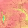
Garden topographic map

Click on the map to display elevation.

About this map

Name: Garden topographic map, elevation, terrain.

Location: Garden, Lucas County, Ohio, United States (41.58422 -83.81633 41.62422 -83.77633)

Average elevation: 204 m

Minimum elevation: 177 m

Maximum elevation: 214 m

Other topographic maps

Click on a map to view its topography, its elevation and its terrain.

Toledo

United States > Ohio > Lucas County

Average elevation: 187 m

Sylvania

United States > Ohio > Lucas County

Average elevation: 203 m

Maumee

United States > Ohio > Lucas County

Average elevation: 192 m

Waterville

United States > Ohio > Lucas County

Average elevation: 197 m

Harbor View

United States > Ohio > Lucas County

Average elevation: 178 m

Toledo

United States > Ohio > Lucas County

Average elevation: 187 m

Toledo

United States > Ohio > Lucas County

Average elevation: 187 m

Maumee

United States > Ohio > Lucas County

Average elevation: 192 m

Ottawa Park

United States > Ohio > Lucas County > Toledo

Average elevation: 189 m

Toledo

United States > Ohio > Lucas County

Average elevation: 187 m

Gear up for your next adventure:

🚰Hydration Packs - Hands‑free water storage for hikers
🪵Fire Starters & Tools - Tools to start fire in wet conditions
📻Emergency Crank Radios - Stay informed in remote areas without power
🧶Camping String Lights - Ambience and utility lighting
🦯Lightweight Trekking Poles - Reduce knee strain on steep Wicklow or Kerry slopes

As an Amazon Associate, this site earns from qualifying purchases at no extra cost to you.