
Thank you for supporting this site ❤️
Make a donation
Make a donation
Gear up for your next adventure:
As an Amazon Associate, this site earns from qualifying purchases at no extra cost to you.
Alpujarras topographic map
Click on the map to display elevation.
Thank you for supporting this site ❤️
Make a donation
Make a donation
Gear up for your next adventure:
As an Amazon Associate, this site earns from qualifying purchases at no extra cost to you.
About this map
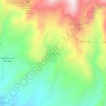
Name: Alpujarras topographic map, elevation, terrain.
Location: Alpujarras, Cacahoatán, Chiapas, Mexico (15.05376 -92.19134 15.09376 -92.15134)
Average elevation: 1,005 m
Minimum elevation: 661 m
Maximum elevation: 1,500 m
Thank you for supporting this site ❤️
Make a donation
Make a donation
Gear up for your next adventure:
As an Amazon Associate, this site earns from qualifying purchases at no extra cost to you.