
Thank you for supporting this site ❤️
Make a donation
Make a donation
Gear up for your next adventure:
As an Amazon Associate, this site earns from qualifying purchases at no extra cost to you.
Ancaiano topographic map
Click on the map to display elevation.
Thank you for supporting this site ❤️
Make a donation
Make a donation
Gear up for your next adventure:
As an Amazon Associate, this site earns from qualifying purchases at no extra cost to you.
About this map
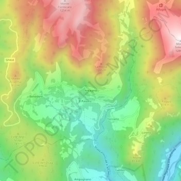
Name: Ancaiano topographic map, elevation, terrain.
Location: Ancaiano, Spoleto, Perugia, Umbria, 06049, Italy (42.62678 12.75337 42.66678 12.79337)
Average elevation: 709 m
Minimum elevation: 245 m
Maximum elevation: 1,276 m
Thank you for supporting this site ❤️
Make a donation
Make a donation
Gear up for your next adventure:
As an Amazon Associate, this site earns from qualifying purchases at no extra cost to you.