
Aberporth topographic map
Interactive map
Click on the map to display elevation.
About this map
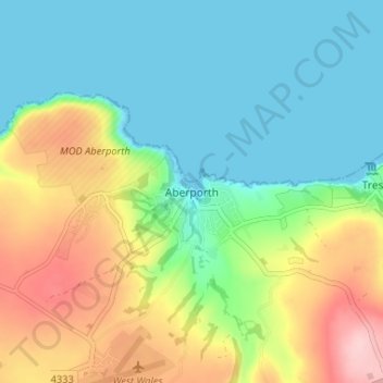
Name: Aberporth topographic map, elevation, terrain.
Location: Aberporth, Ceredigion, Wales, SA43 2DB, United Kingdom (52.11417 -4.56622 52.15417 -4.52622)
Average elevation: 62 m
Minimum elevation: 0 m
Maximum elevation: 184 m
Other topographic maps
Click on a map to view its topography, its elevation and its terrain.
Aberystwyth
United Kingdom > Wales > Ceredigion
Aberystwyth, Ceredigion, Wales, SY23 1LH, United Kingdom
Average elevation: 39 m
Cardigan
United Kingdom > Wales > Ceredigion > Cardigan
Cardigan, Ceredigion, Wales, SA43 1JR, United Kingdom
Average elevation: 81 m
Ynyslas
United Kingdom > Wales > Ceredigion > Borth > Ynyslas
Ynyslas, Borth, Ceredigion, Wales, SY24 5JX, United Kingdom
Average elevation: 1 m