
Arasikere topographic map
Interactive map
Click on the map to display elevation.
About this map
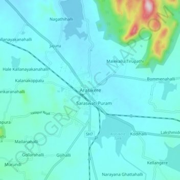
Name: Arasikere topographic map, elevation, terrain.
Average elevation: 835 m
Minimum elevation: 783 m
Maximum elevation: 1,235 m
Arsikere is located at 13°18′52″N 76°15′25″E / 13.31444°N 76.25694°E / 13.31444; 76.25694. It has an average elevation of 812 metres (2,664 feet).