
Oilton topographic map
Interactive map
Click on the map to display elevation.
About this map
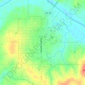
Name: Oilton topographic map, elevation, terrain.
Location: Oilton, Creek County, Oklahoma, 74052, United States (36.07429 -96.59679 36.09091 -96.56490)
Average elevation: 245 m
Minimum elevation: 222 m
Maximum elevation: 282 m