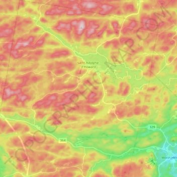
Saint-Adolphe-d'Howard topographic map
Interactive map
Click on the map to display elevation.
About this map
Name: Saint-Adolphe-d'Howard topographic map, elevation, terrain.
Average elevation: 424 m
Minimum elevation: 222 m
Maximum elevation: 593 m

Click on the map to display elevation.
Name: Saint-Adolphe-d'Howard topographic map, elevation, terrain.
Average elevation: 424 m
Minimum elevation: 222 m
Maximum elevation: 593 m