
Hamden topographic map
Interactive map
Click on the map to display elevation.
About this map
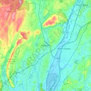
Name: Hamden topographic map, elevation, terrain.
Average elevation: 64 m
Minimum elevation: -3 m
Maximum elevation: 268 m
Other topographic maps
Click on a map to view its topography, its elevation and its terrain.
Milford
United States > Connecticut > South Central Connecticut Planning Region
Milford, South Central Connecticut Planning Region, Connecticut, United States
Average elevation: 18 m