
Les Bochonès topographic map
Interactive map
Click on the map to display elevation.
About this map
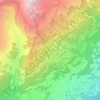
Name: Les Bochonès topographic map, elevation, terrain.
Location: Les Bochonès, Anzère, Ayent, Hérens, Wallis, 1972, Switzerland (46.27904 7.37553 46.31904 7.41553)
Average elevation: 1,588 m
Minimum elevation: 719 m
Maximum elevation: 2,585 m