
Hotton topographic map
Interactive map
Click on the map to display elevation.
About this map
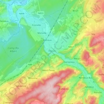
Name: Hotton topographic map, elevation, terrain.
Location: Hotton, Marche-en-Famenne, Luxembourg, Wallonia, 6990, Belgium (50.21631 5.36951 50.31903 5.50341)
Average elevation: 243 m
Minimum elevation: 151 m
Maximum elevation: 405 m
Other topographic maps
Click on a map to view its topography, its elevation and its terrain.
Marche-en-Famenne
Belgium > Luxembourg > Marche-en-Famenne
Marche-en-Famenne, Luxembourg, Wallonia, 6900, Belgium
Average elevation: 270 m