

Slovakia topographic maps
Click on a map to view its topography, its elevation and its terrain.
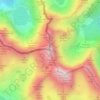
Rysy
Slovakia > Region of Prešov > District of Poprad > Vysoké Tatry
It is possible to ascend the peak from the Slovak side, starting at Štrbské pleso and passing Chata pod Rysmi, a mountain chalet at an altitude of 2,250 m (7,380 ft). Between November 1 and June 15, the trail and chalet on the Slovak side is closed.
Average elevation: 2,005 m
Lazany
Slovakia > Region of Trenčín > District of Prievidza
The municipality lies at an altitude of 316 metres and covers an area of 9.884 km2. It has a population of about 1,571 people.
Average elevation: 323 m
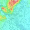
Bratislava
Slovakia > Region of Bratislava
The Carpathian mountain range begins in city territory with the Little Carpathians (Malé Karpaty). The Záhorie and Danubian lowlands stretch into Bratislava. The city's lowest point is at the Danube's surface at 126 metres (413 ft) above mean sea level, and the highest point is Devínska Kobyla at 514 metres…
Average elevation: 168 m
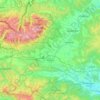
Chopok
Slovakia > Region of Banská Bystrica > District of Brezno > Horná Lehota
Average elevation: 1,642 m
Trnava
Slovakia > Region of Trnava > District of Trnava
Trnava lies at an altitude of 146 metres (479 ft) above sea level and covers an area of 71.535 square kilometres (27.6 sq mi). It is located in the Danubian Lowland on the Trnávka river, around 45 kilometres (28 mi) north-east of Bratislava, 50 kilometres (31 mi) west of Nitra and around 70 kilometres (43 mi)…
Average elevation: 154 m
Komjatná
Slovakia > Region of Žilina > District of Ružomberok
The municipality lies at an altitude of 634 metres and covers an area of 14.543 km2. It has a population of about 1483 people.
Average elevation: 719 m
Prešov
Slovakia > Region of Prešov > District of Prešov
Prešov lies at an altitude of 250 m (820 ft) above sea level and covers an area of 70.4 km2 (27.2 sq mi). It is located in the north-eastern Slovakia, at the northern reaches of the Košice Basin, at the confluence of the Torysa River with its tributary Sekčov. Mountain ranges nearby include Slanské vrchy…
Average elevation: 323 m
Bačka
Slovakia > Region of Košice > District of Trebišov
The village lies at an altitude of 104 metres and covers an area of 9.578 km². It has a population of about 600 people.
Average elevation: 101 m