Southern Province topographic maps
Click on a map to view its topography, its elevation and its terrain.




Ambalangoda
Situated approximately 87 kilometres (54 mi) south of Colombo, it sits on an elevation of 13 metres (43 ft) above the sea level.
Average elevation: 4 m





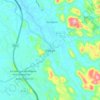

Mirissa
Mirissa (Sinhala: මිරිස්ස, romanized: Mirissa; Tamil: மிரிஸ்ஸ, romanized: Miris'sa) is a small town on the south coast of Sri Lanka, located in the Matara District of the Southern Province. It is approximately 150 kilometres (93 mi) south of Colombo and is situated at an elevation…
Average elevation: 4 m

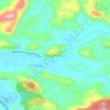
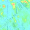
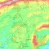










Bentota
Bentota is a coastal town in Sri Lanka, located in the Galle District of the Southern Province. It is approximately 65 kilometres (40 mi) south of Colombo and 56 kilometres (35 mi) north of Galle. Bentota is situated on the southern bank of the Bentota River mouth, at an elevation of 3 metres (9.8 ft) above…
Average elevation: 2 m


Weligama
Weligama (Sinhala: වැලිගම, Tamil: வெலிகாமம்) is a town on the south coast of Sri Lanka, located in Matara District, Southern Province, Sri Lanka, governed by an Urban Council. The name Weligama, literally means "sandy village" which refers to the area's sandy sweep bay. It is…
Average elevation: 7 m