
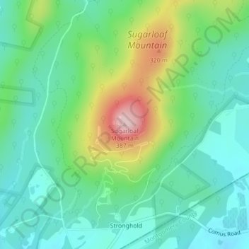
Sugarloaf Mountain topographic map
Interactive map
Click on the map to display elevation.
About this map
Name: Sugarloaf Mountain topographic map, elevation, terrain.
Location: Sugarloaf Mountain, Frederick County, Maryland, 20842, USA (39.26238 -77.39330 39.26248 -77.39320)
Average elevation: 200 m
Minimum elevation: 126 m
Maximum elevation: 378 m
Other topographic maps
Click on a map to view its topography, its elevation and its terrain.
Williams Wharf
USA > Maryland > Williams Wharf
Williams Wharf, Calvert County, Maryland, 20615, USA
Average elevation: 13 m
Grahams Green Acres
USA > Maryland > Grahams Green Acres
Grahams Green Acres, Carroll County, Maryland, 21776, USA
Average elevation: 223 m
Lexington Park
USA > Maryland > Lexington Park
Lexington Park, Saint Mary's County, Maryland, USA
Average elevation: 15 m