
Welshpool topographic map
Interactive map
Click on the map to display elevation.
About this map
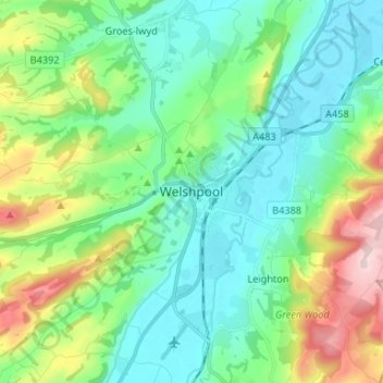
Name: Welshpool topographic map, elevation, terrain.
Location: Welshpool, Powys, Wales, SY21, United Kingdom (52.62007 -3.18742 52.70007 -3.10742)
Average elevation: 156 m
Minimum elevation: 63 m
Maximum elevation: 412 m