
Wychavon topographic map
Interactive map
Click on the map to display elevation.
About this map
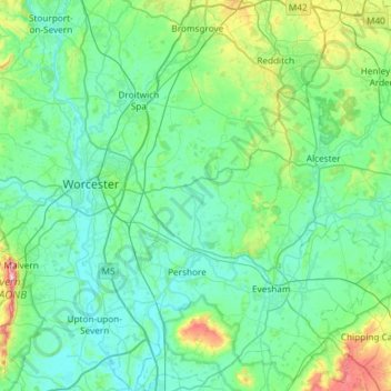
Name: Wychavon topographic map, elevation, terrain.
Location: Wychavon, Worcestershire, England, United Kingdom (51.99941 -2.27605 52.36121 -1.75741)
Average elevation: 68 m
Minimum elevation: 6 m
Maximum elevation: 418 m