
Lentini topographic map
Interactive map
Click on the map to display elevation.
About this map
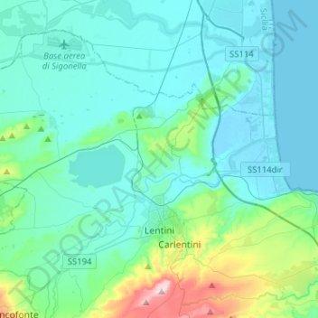
Name: Lentini topographic map, elevation, terrain.
Location: Lentini, SR, Sicily, 96016, Italy (37.24783 14.77834 37.41288 15.03319)
Average elevation: 69 m
Minimum elevation: -1 m
Maximum elevation: 480 m