
els Plans topographic map
Interactive map
Click on the map to display elevation.
About this map
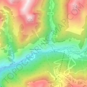
Name: els Plans topographic map, elevation, terrain.
Location: els Plans, Canillo, AD100, Andorra (42.56215 1.61298 42.60215 1.65298)
Average elevation: 2,021 m
Minimum elevation: 1,540 m
Maximum elevation: 2,579 m