
Landshut topographic map
Interactive map
Click on the map to display elevation.
About this map
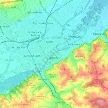
Name: Landshut topographic map, elevation, terrain.
Location: Landshut, Lower Bavaria, Bavaria, Germany (48.51129 12.10932 48.56536 12.20764)
Average elevation: 422 m
Minimum elevation: 382 m
Maximum elevation: 524 m