
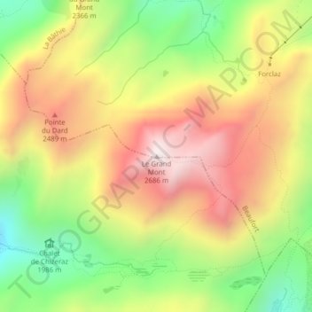
Le Grand Mont topographic map
Interactive map
Click on the map to display elevation.
About this map
Name: Le Grand Mont topographic map, elevation, terrain.
Average elevation: 2,244 m
Minimum elevation: 1,803 m
Maximum elevation: 2,677 m
Other topographic maps
Click on a map to view its topography, its elevation and its terrain.
Col du Pré
France > Auvergne-Rhône-Alpes > Beaufort
Col du Pré, , Les Lanches, Beaufort, Albertville, Savoy, Auvergne-Rhône-Alpes, Metropolitan France, 73270, France
Average elevation: 1,561 m