
Henderson topographic map
Interactive map
Click on the map to display elevation.
About this map
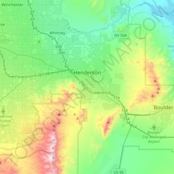
Name: Henderson topographic map, elevation, terrain.
Location: Henderson, Clark County, Nevada, USA (35.89182 -115.21936 36.12498 -114.90220)
Average elevation: 691 m
Minimum elevation: 364 m
Maximum elevation: 1,538 m