
Lough Salt topographic map
Interactive map
Click on the map to display elevation.
About this map
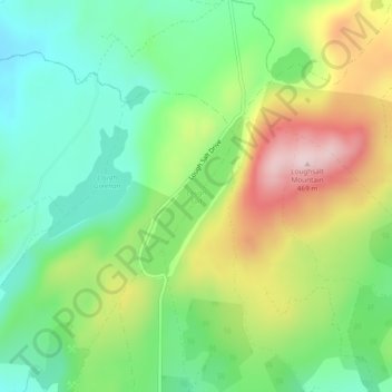
Name: Lough Salt topographic map, elevation, terrain.
Location: Lough Salt, Glen ED, Letterkenny, County Donegal, Ireland (55.07768 -7.81221 55.08873 -7.79976)
Average elevation: 246 m
Minimum elevation: 119 m
Maximum elevation: 454 m
Ireland trails, hiking, mountain biking, running and outdoor activities
Other topographic maps
Click on a map to view its topography, its elevation and its terrain.