
Galway Bay topographic map
Interactive map
Click on the map to display elevation.
About this map
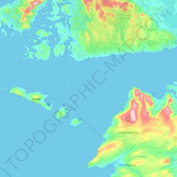
Name: Galway Bay topographic map, elevation, terrain.
Location: Galway Bay, County Galway, Connacht, Ireland (53.03502 -9.78882 53.26172 -8.98750)
Average elevation: 35 m
Minimum elevation: -2 m
Maximum elevation: 346 m
County Galway trails, hiking, mountain biking, running and outdoor activities
Other topographic maps
Click on a map to view its topography, its elevation and its terrain.