
Shannon Municipal District topographic map
Interactive map
Click on the map to display elevation.
About this map
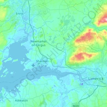
Name: Shannon Municipal District topographic map, elevation, terrain.
Location: Shannon Municipal District, County Clare, Munster, Ireland (52.66153 -8.99690 52.80161 -8.50165)
Average elevation: 35 m
Minimum elevation: -26 m
Maximum elevation: 418 m
County Clare trails, hiking, mountain biking, running and outdoor activities
Other topographic maps
Click on a map to view its topography, its elevation and its terrain.