
Thomastown topographic map
Interactive map
Click on the map to display elevation.
About this map
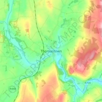
Name: Thomastown topographic map, elevation, terrain.
Location: Thomastown, County Kilkenny, Leinster, Ireland (52.48517 -7.17825 52.56517 -7.09825)
Average elevation: 71 m
Minimum elevation: 5 m
Maximum elevation: 183 m
Ireland trails, hiking, mountain biking, running and outdoor activities