
Cashel topographic map
Interactive map
Click on the map to display elevation.
About this map
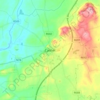
Name: Cashel topographic map, elevation, terrain.
Location: Cashel, County Tipperary, Munster, Ireland (52.47674 -7.92794 52.55674 -7.84794)
Average elevation: 111 m
Minimum elevation: 62 m
Maximum elevation: 206 m