
Kilkee topographic map
Interactive map
Click on the map to display elevation.
About this map
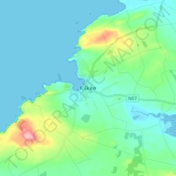
Name: Kilkee topographic map, elevation, terrain.
Location: Kilkee, County Clare, Munster, Ireland (52.63917 -9.68417 52.71917 -9.60417)
Average elevation: 24 m
Minimum elevation: -1 m
Maximum elevation: 133 m