
Inch topographic map
Interactive map
Click on the map to display elevation.
About this map
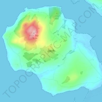
Name: Inch topographic map, elevation, terrain.
Location: Inch, Inishowen Municipal District, County Donegal, Ireland (55.04748 -7.53315 55.08502 -7.45947)
Average elevation: 29 m
Minimum elevation: -5 m
Maximum elevation: 210 m
County Donegal trails, hiking, mountain biking, running and outdoor activities
Other topographic maps
Click on a map to view its topography, its elevation and its terrain.