
Kilnaboy Parish topographic map
Interactive map
Click on the map to display elevation.
About this map
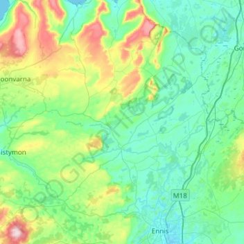
Name: Kilnaboy Parish topographic map, elevation, terrain.
Location: Kilnaboy Parish, County Clare, Munster, Ireland (52.86565 -9.24127 53.08764 -8.74780)
Average elevation: 78 m
Minimum elevation: 0 m
Maximum elevation: 386 m
County Clare trails, hiking, mountain biking, running and outdoor activities
Other topographic maps
Click on a map to view its topography, its elevation and its terrain.