
Madison County topographic map
Interactive map
Click on the map to display elevation.
About this map
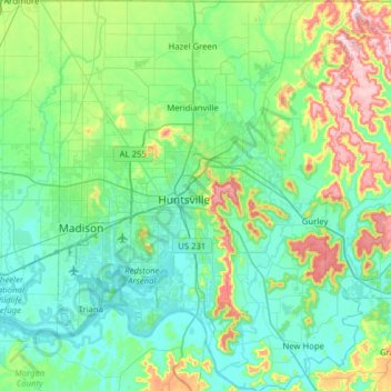
Name: Madison County topographic map, elevation, terrain.
Location: Madison County, Alabama, United States (34.47666 -86.79009 34.99207 -86.25830)
Average elevation: 245 m
Minimum elevation: 166 m
Maximum elevation: 565 m
The topography in the southern and eastern portions of the county is dominated by the dissected remnants of the Cumberland Plateau, such as Keel Mountain, Monte Sano Mountain and Green Mountain. The northern and western portions of the county are flatter.