
Gloucester topographic map
Interactive map
Click on the map to display elevation.
About this map
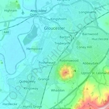
Name: Gloucester topographic map, elevation, terrain.
Location: Gloucester, Gloucestershire, England, United Kingdom (51.80757 -2.30139 51.88522 -2.17726)
Average elevation: 36 m
Minimum elevation: 4 m
Maximum elevation: 274 m
Other topographic maps
Click on a map to view its topography, its elevation and its terrain.
Cheltenham
United Kingdom > England > Gloucestershire
Cheltenham, Gloucestershire, England, United Kingdom
Average elevation: 109 m
Cirencester
United Kingdom > England > Gloucestershire > Cotswold District > Chesterton
Cirencester, Chesterton, Cotswold District, Gloucestershire, England, United Kingdom
Average elevation: 128 m