
Peoria Heights topographic map
Interactive map
Click on the map to display elevation.
About this map
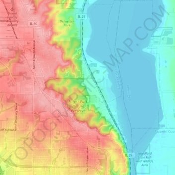
Name: Peoria Heights topographic map, elevation, terrain.
Average elevation: 182 m
Minimum elevation: 133 m
Maximum elevation: 251 m
Topographically, the village can be roughly divided into three zones. The Illinois River floodplain, the bluff, and the plateau. While its eastern border is fairly regular with the river's edge, the rest of its municipal border, with Peoria, is quite irregular and convoluted.