
Tooele topographic map
Interactive map
Click on the map to display elevation.
About this map
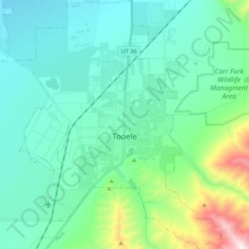
Name: Tooele topographic map, elevation, terrain.
Location: Tooele, Tooele County, Utah, 84074, United States (40.48017 -112.36318 40.59199 -112.24130)
Average elevation: 1,610 m
Minimum elevation: 1,328 m
Maximum elevation: 2,854 m