
Ciluar topographic map
Interactive map
Click on the map to display elevation.
About this map
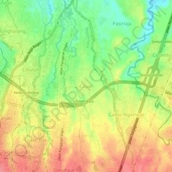
Name: Ciluar topographic map, elevation, terrain.
Location: Ciluar, West Java, 16156, Indonesia (-6.58532 106.80845 -6.54532 106.84845)
Average elevation: 196 m
Minimum elevation: 156 m
Maximum elevation: 232 m