
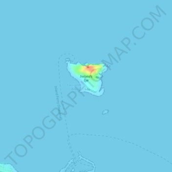
Ireland's Eye topographic map
Interactive map
Click on the map to display elevation.
About this map
Name: Ireland's Eye topographic map, elevation, terrain.
Average elevation: 0 m
Minimum elevation: -5 m
Maximum elevation: 43 m
Other topographic maps
Click on a map to view its topography, its elevation and its terrain.
Irelands Eye
Irelands Eye, Howth ED, Howth, Fingal, County Dublin, Leinster, Ireland
Average elevation: 0 m