
Kinnity topographic map
Interactive map
Click on the map to display elevation.
About this map
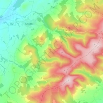
Name: Kinnity topographic map, elevation, terrain.
Average elevation: 251 m
Minimum elevation: 68 m
Maximum elevation: 526 m
Other topographic maps
Click on a map to view its topography, its elevation and its terrain.
Killyon
Ireland > The Municipal District of Birr > Killyon
Killyon, The Municipal District of Birr, County Offaly, Leinster, Ireland
Average elevation: 75 m