
Powell County topographic map
Interactive map
Click on the map to display elevation.
About this map
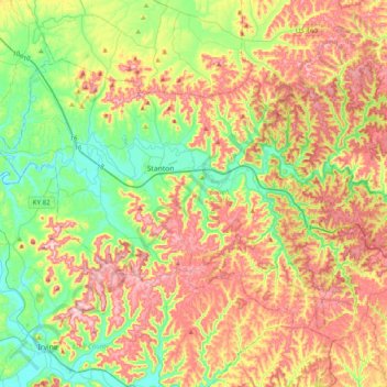
Name: Powell County topographic map, elevation, terrain.
Location: Powell County, Kentucky, United States of America (37.71611 -84.02782 37.93375 -83.63126)
Average elevation: 293 m
Minimum elevation: 177 m
Maximum elevation: 442 m
Other topographic maps
Click on a map to view its topography, its elevation and its terrain.
Williamstown
United States of America > Kentucky > Williamstown
Williamstown, Grant County, Kentucky, 41097, United States of America
Average elevation: 262 m
Cumberland County
United States of America > Kentucky
Cumberland County, Kentucky, United States of America
Average elevation: 237 m
Edmonson County
United States of America > Kentucky
Edmonson County, Kentucky, United States of America
Average elevation: 196 m
Green County
United States of America > Kentucky
Green County, Kentucky, United States of America
Average elevation: 230 m