
Malmedy topographic map
Interactive map
Click on the map to display elevation.
About this map
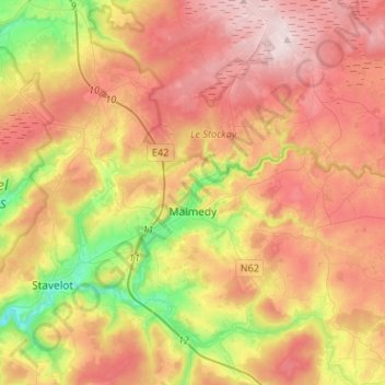
Name: Malmedy topographic map, elevation, terrain.
Location: Malmedy, Verviers, Liège, Wallonia, 4960, Belgium (50.35031 5.96961 50.51897 6.11361)
Average elevation: 489 m
Minimum elevation: 251 m
Maximum elevation: 701 m
Malmedy has an oceanic climate with continental influences due to its inland position and higher elevation. Winter can see ice days, strong air frosts and snowfall. Malmedy's high precipitation is commonly affecting the nearby Spa-Francorchamps race track, known for its treacherous weather conditions.