
Rathdrum topographic map
Interactive map
Click on the map to display elevation.
About this map
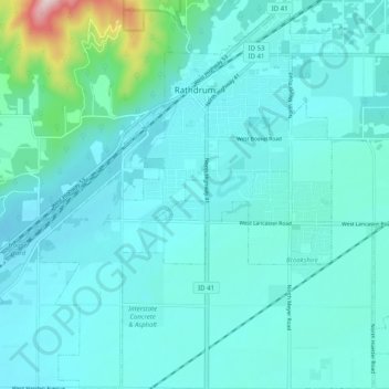
Name: Rathdrum topographic map, elevation, terrain.
Location: Rathdrum, Kootenai County, Idaho, United States (47.75943 -116.93716 47.82660 -116.86172)
Average elevation: 701 m
Minimum elevation: 649 m
Maximum elevation: 1,084 m
Rathdrum is located on the Rathdrum Prairie at 47°48′30″N 116°53′33″W / 47.80833°N 116.89250°W / 47.80833; -116.89250 (47.808457, -116.892415), at an elevation of 2,211 feet (674 m) above sea level.