
Deal topographic map
Interactive map
Click on the map to display elevation.
About this map
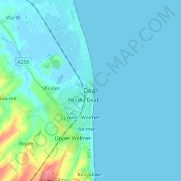
Name: Deal topographic map, elevation, terrain.
Location: Deal, Kent, South East, England, CT14 6EL, United Kingdom (51.18392 1.36287 51.26392 1.44287)
Average elevation: 8 m
Minimum elevation: -3 m
Maximum elevation: 76 m