
Gregory County topographic map
Interactive map
Click on the map to display elevation.
About this map
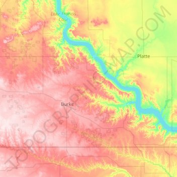
Name: Gregory County topographic map, elevation, terrain.
Location: Gregory County, South Dakota, USA (42.99797 -99.53301 43.49973 -98.49855)
Average elevation: 564 m
Minimum elevation: 408 m
Maximum elevation: 729 m
Other topographic maps
Click on a map to view its topography, its elevation and its terrain.
Sioux Falls
USA > South Dakota > Sioux Falls
Sioux Falls, Minnehaha County, South Dakota, USA
Average elevation: 439 m
Mount McKinley
Mount McKinley, Harding County, South Dakota, USA
Average elevation: 980 m