
Brussels topographic map
Interactive map
Click on the map to display elevation.
About this map
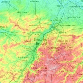
Name: Brussels topographic map, elevation, terrain.
Location: Brussels, Brussels-Capital, 1010, Belgium (50.68656 4.19170 51.00656 4.51170)
Average elevation: 54 m
Minimum elevation: -1 m
Maximum elevation: 144 m
Other topographic maps
Click on a map to view its topography, its elevation and its terrain.