
High Tatras topographic map
Interactive map
Click on the map to display elevation.
About this map
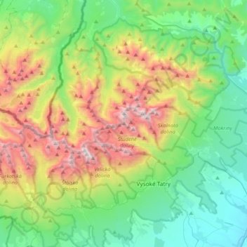
Name: High Tatras topographic map, elevation, terrain.
Average elevation: 1,268 m
Minimum elevation: 647 m
Maximum elevation: 2,611 m
Other topographic maps
Click on a map to view its topography, its elevation and its terrain.
Lomnicky Peak
Slovakia > Region of Prešov > District of Poprad
Lomnicky Peak, District of Poprad, Region of Prešov, Eastern Slovakia, Slovakia
Average elevation: 2,052 m