
Yangambi topographic map
Interactive map
Click on the map to display elevation.
About this map
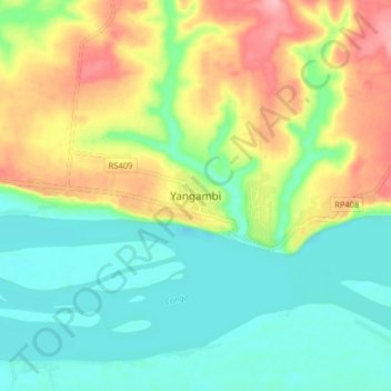
Name: Yangambi topographic map, elevation, terrain.
Location: Yangambi, Tshopo, Democratic Republic of the Congo (0.72583 24.43336 0.80583 24.51336)
Average elevation: 409 m
Minimum elevation: 364 m
Maximum elevation: 486 m