
Ingleside on the Bay topographic map
Interactive map
Click on the map to display elevation.
About this map
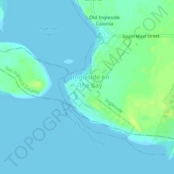
Name: Ingleside on the Bay topographic map, elevation, terrain.
Location: Ingleside on the Bay, San Patricio County, Texas, USA (27.82182 -97.22835 27.83803 -97.21508)
Average elevation: 4 m
Minimum elevation: -1 m
Maximum elevation: 16 m