
Cherokee County topographic map
Interactive map
Click on the map to display elevation.
About this map
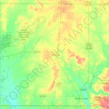
Name: Cherokee County topographic map, elevation, terrain.
Location: Cherokee County, Kansas, USA (36.99860 -95.07385 37.34171 -94.61764)
Average elevation: 266 m
Minimum elevation: 235 m
Maximum elevation: 319 m
Other topographic maps
Click on a map to view its topography, its elevation and its terrain.
Westmoreland
USA > Kansas > Westmoreland
Westmoreland, Pottawatomie County, Kansas, USA
Average elevation: 371 m