
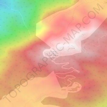
Guru Shikhar, Abu topographic map
Interactive map
Click on the map to display elevation.
About this map
Name: Guru Shikhar, Abu topographic map, elevation, terrain.
Average elevation: 1,366 m
Minimum elevation: 594 m
Maximum elevation: 1,706 m
Other topographic maps
Click on a map to view its topography, its elevation and its terrain.
Barmer
India > Rajasthan > Barmer Tehsil
Barmer, Barmer Tehsil, Barmer District, Rajasthan, 344001, India
Average elevation: 188 m
Alpa
India > Rajasthan > Sheoganj Tehsil
Alpa, Sheoganj Tehsil, Sirohi District, Rajasthan, India
Average elevation: 254 m
Aravalli Range
Aravalli Range, Abu Road Tehsil, Sirohi, Rajasthan, 307501, India
Average elevation: 1,339 m