
Hart County topographic map
Interactive map
Click on the map to display elevation.
About this map
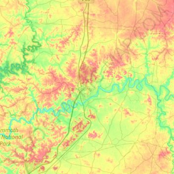
Name: Hart County topographic map, elevation, terrain.
Location: Hart County, Kentucky, USA (37.14811 -86.15750 37.44993 -85.65115)
Average elevation: 219 m
Minimum elevation: 137 m
Maximum elevation: 345 m
Other topographic maps
Click on a map to view its topography, its elevation and its terrain.
Georgetown
USA > Kentucky > Georgetown
Georgetown, Scott County, Kentucky, 40324, USA
Average elevation: 265 m