
Cambridge topographic map
Interactive map
Click on the map to display elevation.
Cambridge
Cambridge obtains water from Hobbs Brook (in Lincoln and Waltham) and Stony Brook (Waltham and Weston), as well as an emergency connection to the Massachusetts Water Resources Authority. The city owns over 1,200 acres (486 ha) of land in other towns that includes these reservoirs and portions of their watershed. Water from these reservoirs flows by gravity through an aqueduct to Fresh Pond in Cambridge. It is then treated in an adjacent plant and pumped uphill to an elevation of 176 feet (54 m) above sea level at the Payson Park Reservoir (Belmont). The water is then redistributed downhill via gravity to individual users in the city. A new water treatment plant opened in 2001.
About this map
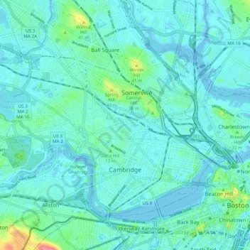
Name: Cambridge topographic map, elevation, terrain.
Location: Cambridge, Middlesex County, Massachusetts, United States (42.35240 -71.16040 42.40426 -71.06398)
Average elevation: 11 m
Minimum elevation: -5 m
Maximum elevation: 73 m
Other topographic maps
Click on a map to view its topography, its elevation and its terrain.
North Chelmsford
United States > Massachusetts > Middlesex County > Chelmsford
Average elevation: 41 m
Arlington Heights
United States > Massachusetts > Middlesex County > Arlington
Average elevation: 58 m
Cambridge
United States > Massachusetts > Middlesex County > Cambridge
Cambridge obtains water from Hobbs Brook (in Lincoln and Waltham) and Stony Brook (Waltham and Weston), as well as an emergency connection to the Massachusetts Water Resources Authority. The city owns over 1,200 acres (486 ha) of land in other towns that includes these reservoirs and portions of their…
Average elevation: 31 m
Weston Station
United States > Massachusetts > Middlesex County > Weston > Weston Station
Average elevation: 55 m
East Acton
United States > Massachusetts > Middlesex County > Acton > East Acton
Average elevation: 53 m
Newton
United States > Massachusetts > Middlesex County > Newton
Newton has grown around a formation of seven hills. "The general features of Newton are not without interest. Seven principal elevations mark its surface, like the seven hills of ancient Rome, with the difference that the seven hills of Newton are much more distinct than the seven hills of Rome: Nonantum Hill,…
Average elevation: 43 m
Glendale
United States > Massachusetts > Middlesex County > Everett > Glendale
Average elevation: 14 m